Saturday, August 18, 2012

Wonderland : Day 3

"Many of us would probably be better fisherman if we did not spend so much time watching and waiting for the world to become perfect."
-Norman Maclean - A River Runs Through It

I awoke just before sunrise.  Excited, nervous, determined, and still quite sore.  My family was still asleep in the tent.  I filled my pack with the same provisions as day 1 and headed out as the sun was coming up over Mowich Lake.  After a quick climb through the forest the trail suddenly opens up with Ipsut Pass.  Pretty sweet!


Then the bottom drops out.  The steep descent loses about 1,100 ft over the first mile or so and then another 1,600 ft over 4 more miles of descent, which put a hurtin' on my tender legs.  I think because the 93-mile elevation profile was so scrunched together I failed to grasp how LONG the ascents and descents were. 


I was a bit nervous that my legs wouldn't hold out since they were really getting sore.  So early in the day I put my head in the right place.  I wasn't going to concern myself about pace.  (That was my plan from the very start but I really didn't do it...)   If I did 15-20 minute-miles the whole time, so be it.   I think this made a huge difference.   And after a while, my legs actually became sort of hardened ("annealed" seemed to describe it best at the time).  They were still sore and very stiff but they really didn't hurt....and I actually felt pretty strong.

A hobbit house for sure.


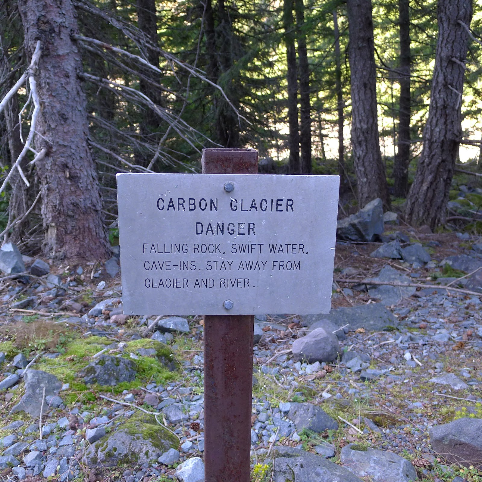
Just past Ipsut creek the trail ascended for a solid 7 miles and 3,600 ft!!  I just put it in cruise control and charged. I gotta say it was an awesome climb.  I felt good, the legs were strong, the weather was great, and the country was beautiful.  I passed a couple of hikers and actually felt a little sorry for them having to lug big packs up that far.  Carbon glacier was crazy since I was wondering where in the world it was....then I realized it was right in front of me as a big chunk of ice broke off and violently rolled down the gacier face.  The dirty glacier blended right in to the rock and earth around it. 


Carbon Glacier.  And you thought glaciers were white!


Switchbacks.  I was on the up and up!


Rainier
I finally dropped back down through a sub-alpine valley complete with Ranier views, wildflowers, and Mystic Lake.  But descent was short-lived as a 2,100 ft, 3-mile climb followed.  This climb also went well and dumped me out on on an exposed alpine meadow.


PBJ stop at Mystic Lake.


I got up and over Skyscraper Pass, which had some of the best views of the entire trip.  At this point I began seeing bunches of folks out day hiking around and I knew I was almost there.  I descended through Berkeley Park to Sunrise where I just happened to pass my family out for a day hike and then back down to White River where I started. 


Berkeley Park (if you look closely, you can see the trail off in the distance)

Shadow Lake


I really had a awesome day out there.  It totaled about 29 miles and over 6,000 ft of elevation gain in around 8 hrs. 

I learned plenty during this trip.  Not only about how to better piece together a long multi-day trail run, but also how to stay focused and to keep myself under control when things don't go as planned.  And that adjusting goals are sweeter when they include hiking with the people I love.  I gained the confidence that I need to be able to run past the point where my body seems broken down.  Finally, I am proud of myself for doing what can typically be the hardest part...the initial commitments like hitting "purchase" when looking at the airplane tickets and, of course, taking those first few steps into the wild. 

There really are perfect parts of our world.  They just aren't man made.  Which is ironic, because we do tend to sit around and wait for things to get better and become more perfected by us humans.  In the end, I left Rainier National Park motivated more than ever to see more of these perfect places and to have more adventures.  

A big thanks to my family for crewing and putting up with me!


Tuesday, August 14, 2012

Wonderland : Day 2

"But what I remember best is crawling out of the tent on summer nights when on high mountains autumn is always approaching.  To a boy, it is something new and beautiful to piss among the stars.  Not under the stars but among them. Even at night great winds seem always to blow on great mountains, and tops of trees bend, but, as the boy stands there with nothing to do but to watch, seemingly the sky itself bends and the stars blow down through the trees until the Milky Way becomes lost in some distant forest.  As the cosmos brushes by the boy and disappears among the trees, the sky is continually replenished with stars.  There would be stars enough to brush by him all night, but by now the boy is getting cold."
-Norman Maclean, A River Runs Through It

I woke up feeling just ok about my decision not run the second day.  After all, I had a lot of reasons not to head out...  I could hike with my family.  I could have coffee, and cook bacon and eggs.  I could make sure my family made it to Mowich Lake ok.  But I was ultimately worried about heading back out for a long day on tired legs by myself.  There were no road crossings on this second section and it was pretty remote.  This meant that once I started out, my family would leave for Mowich, and I would be committed.  Although I've run fifty miles at a time on multiple occasions, I had never tested my legs to that extent on consecutive days.  It also turned out to be socked in with fog at high elevations so I'm not sure how I would have found my way through snowy sections if I couldn't locate my position in very low visibility.  In the end, I still had a great day in the mountains with my family....and of course, I still regret not going out on the second day.  Such is life.  I want it all!

We started the day off with a quick hike down to a river that I passed on the way in that was pretty awesome.   Then I ran a couple of miles to Longmire visitors center just to add a bit more of the wonderland trail to my bag. 


After Longmire, we stopped by a sweet backwoods metal sculpture place and then hustled to get to Mowich Lake (the second campsite of the original plan) in time for a good hike after setting up the tent.  Mowich Lake has a small walk-in campground on the more remote west side of the national park. We chose to hike a little over 5 miles round trip up to Eunice Lake and back.


Tully and Olive's summer rock climbing camp came in handy.


Eunice Lake frosted over.

The Fire Lookout is visible on Tolmie Peak


The kids rocked the hike.  After we returned to the campsite we ate dinner and Olive and I walked around crystal clear Mowich Lake together at dusk before turning in for the night.


Mowich Lake.  So clear that the submerged timbers shine through the reflection. 

Not a bad substitute second day!  That said, I went to sleep excited and motivated to get out early the next morning and salvage the remainder of the Wonderland Trail.

Monday, August 6, 2012

Wonderland : Day 1

"I also knew I was being challenged.  This was the world of the woods and the working stiff, the logging camp being a world especially overbearing with challenges, and, if you expected to duck all challenges, you shouldn't have wandered into the woods in the first place."
-Norman Maclean, A River Runs Through It

Where in the world is the trail?  How in the world will I make it tomorrow? Wow, it sure is beautiful out here!  What is around the next bend, or over the next pass? These were the thoughts that persistently occupied my mind on the first day of my attempt to run around the Wonderland Trail in three days. 

My family and I arrived in the Pacific Northwest last Thursday and headed directly to just outside the Sunrise entrance to the Mt Rainier National Park.  We stopped along the way at a couple of small roadside markets for vegetables and meat; the local cherries, blueberries, housemade elk jerky, kielbasa, bacon and smoked salmon were delicious highlights throughout our journey. 

That night, I packed my small Nathan HPL #020 pack with some water, a squeeze filter (highly recommended at 3 oz), shotblocks, map, compass, camera, endurolytes, advil, a second garmin watch, and a pbj sandwich.  That's about it.  My plan for the next morning was to run from White River Campground to Cougar Rock Campground, about 30 miles and 6,000 feet of elevation gain. 

The next morning I stopped in at the Sunrise Ranger station to register.  After he pulled my permits he mentioned that it would be nice but "plenty of snow".  I thought, sure maybe a few patches of snow.  It was the end of July after all.  I asked him what color the blazes were, and he responded that there are no blazes.  Hmmm, that's interesting for a major trail in a national park.

At the trail head, I kissed my family goodbye and trotted off.  I felt great and was super excited.  Although I knew this was the best I'd physically feel for the next three days.


After some nice cruising trail through the forest I started climbing.  I climbed up to Sumerland shelter which was just at sub-alpine level.  I saw a Marmot messing around and cleaning up after previous visitors. 


Very shortly after Summerland, the mountain opened up into alpine peaks, valleys, passes, bowls, couloirs....and snow.  Bunches of snow. I found some faint tracks and followed them up.  Within a quarter of a mile I had lost the tracks and was heading up into a big bowl.  I pulled out my map for the first time (of many) and realized I was off course. 


I corrected and found tracks again after about another quarter mile.  I eventually passed a couple of female hikers coming the opposite direction and made my way up over Panhandle pass.  Passes are always spectacular in the high mountains....never "pass" on a chance to hike to one if you are within striking distance.

Panhandle Pass


Once over Panhandle pass the trail was completely covered in snow.  I was barely able to make out a couple of hikers tracks and scrambled across.  I just hoped they knew where they were going!


The Trail cuts across the snow covered expanse.  One of the few hikers I passed can be seen in lower right.
I pushed through long sections of snow, running as much as I could.  Without a trail, there were no switchbacks, which meant following a simple bearing on all fours up and over climbs.  I slid and glided along various grades.  And I checked the map frequently just to make sure.  I was in another world.


Rare Trail Above Treeline


Long snow covered descent to Indian Bar.  Slip slideee!!


The trail descended through the snow down to Indian Bar.  At this point (about 12 miles in), I saw the last two hikers I would see for a long while.  This was significant because they had a gps and I had been roughly following their footsteps.  At this point, the trail went cold, so to speak.  I had no footsteps to follow, no blazes, no cairns.  Thank God I had my map and compass.  I could have easily left the compass behind, since I had assumed the well-known trail in a national park would have been well traveled and well marked.  Additionally, it was hot and humid in Georgia as I was packing.  Snow was the last thing on my mind.   


As I ascended out of Indian Bar, I started to check the map and compass frequently.  I was simply following a bearing over blank expanses of snow for a while.  Every once in a while, I would eventually come to grassy spots or steep drop offs with no sign of trail.  I would scratch my head, check the map, the compass, and correct.  I became frustrated and a little nervous. The miles were taking much longer than planned.  I tried to pick up the pace to compensate, which didn't help.

At one point during some head scratching, I passed what looked like bear droppings, and as I was trying to find trail, smelled the strong scent of a beast.  It surely didn't help the nerves.


The trail descends along the ribbon of snow along the ridge.

Finally I had descended back down below treeline.  After the huge 6 mile descent I bottomed out in Box Canyon.  It was comforting to be back on trail and simply running again.  My legs were starting to feel heavy though.  With my mind finally off of route finding, I began trying to figure out how I was going to be able to do the next day.  Out of Box Canyon, I began to climb up the 5-mile, 2,000-ft ascent to Reflection Lake. 


Almost immediately on the long climb I began to feel pretty terrible.  And the worse I felt, the more I told myself I wouldn't be able to do the next day.  I felt nauseous and my legs were a wreck.  I was taking a few steps at a time.   I think the snow sections earlier in the day really set me back by not focusing on eating well and really spinning my wheels.  Seeing the numerous wildflowers and waterfalls helped slightly, but were really no match for the funk that I was in for a couple of hours. 


I finally arrived at the Cougar Rock campground 9 hours after the day began and 30 miles of spectacular country away from where I had started.  Unfortunately, I was determined to not go out for the second day.  I had fears that my legs wouldn't hold up.  And fears that I wouldn't be able to find trail, especially since it was socked in.  And fears that I would be miserable all day.  Although Allison provided plenty of encouragement, I decided to just hike with my family the next day and then start again on the last 30 mile segment the day after.  At the time, I felt sure that I wouldn't regret my decision. 

Stay tuned for reports on Days 2 and 3!